KML Viewer Online - .kml .kmz Data visualizer on Map
Curious to see your KML or KMZ data on an interactive map without any desktop software? Want to view kml file in web browser?
KML and KMZ file formats are used to store geographic data in the form of points, Lines, and Polygons. KML is the short form of Keyhole Markup Language and KMZ is zipped version of KML. It is XML based plain text format to represent the geographic data.
This geodata file format is widely used by Google mapping products like Google Earth and Google Maps. It is very lightweight text based geodata file format and used by professionals, researchers and students on daily bases.
We have developed a very simple, basic and intuitive .kml .kmz file viewer online free web tool using free resources and libraries with no proprietary software involved. Kmz Kml file viewer free web map application is very easy to use.
Key Features of KML Data Visualizer:
User Guide: How to View KML Data on Map? Step By Step
This free webgis tool is quite straight forward to use and can display your GIS data in .kml or .kmz file format in few clicks.
Step 1: Browse file location on local computer
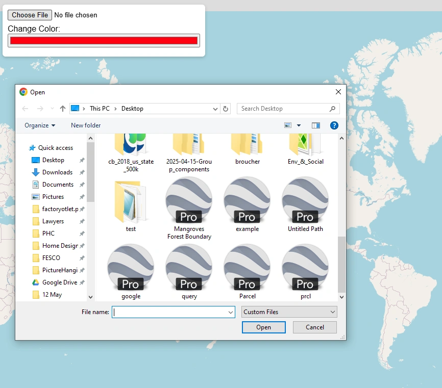
Click on choose file button. A file browser on your PC will be opened. Browse the kml file location and select. Now press open. File will be automatically loaded on map and map will be zoom to the extent of data.
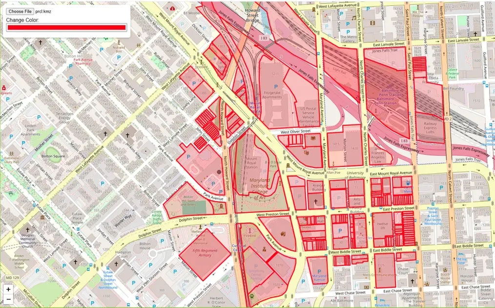
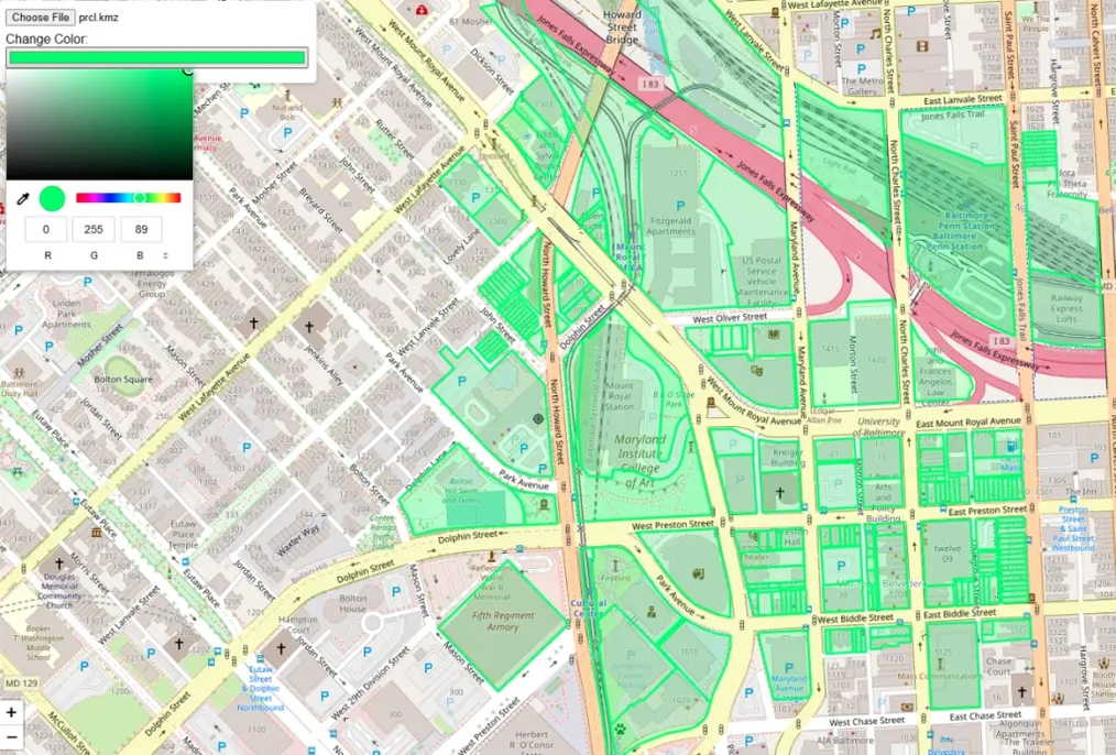
Step 2: Change The Colors of Map
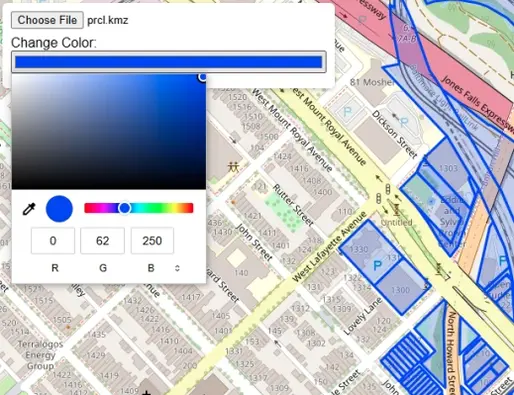
Once geodata is successfully loaded on map, now you can change the color of map. Click on color button a color picker will be opened. Choose the color and click on map.
Step 3: Change Basemap
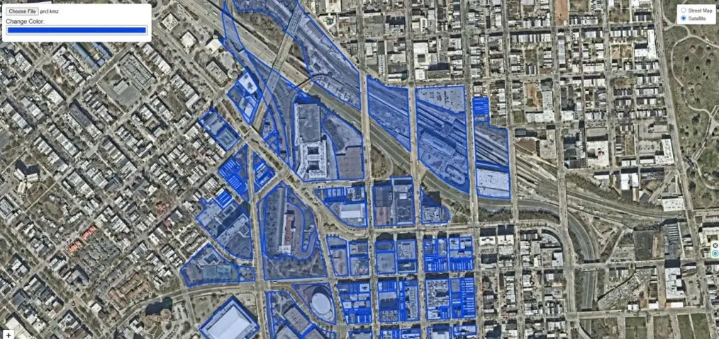
On upper right corner you can see a layer icon. Click on the button, it will show basemap switching options from streetmap to satellite.
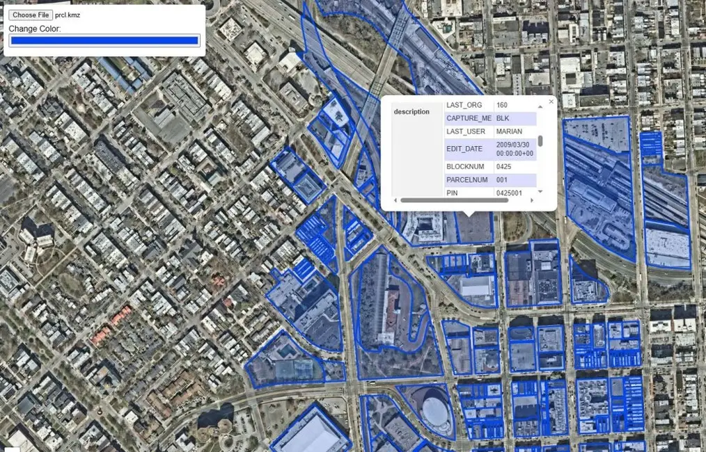
Step 4: Click on Feature to Get Relevant Information in Popup Window

Click on any feature on map. It will show a popup information window with relevant information stored in the data.
A Brief History of the KML File
The KML (Keyhole Markup Language) file format was originally developed by Keyhole Inc. in the early 2000s as a way to display geographic data in the company’s 3D Earth visualization software, Keyhole Earth Viewer.
In 2004, Google acquired Keyhole Inc., rebranding the software as Google Earth. KML quickly became the standard format for sharing geographic information such as placemarks, paths, and polygons within Google Earth and later Google Maps.
Recognizing its growing importance, the Open Geospatial Consortium (OGC) officially adopted KML as an international standard in 2008, ensuring compatibility across multiple GIS and mapping platforms.
Today, KML—and its compressed version, KMZ—remain popular formats for sharing and visualizing geospatial data across the web, mobile apps, and desktop mapping software.
Key Differences Between KML and KMZ Files
Although KML and KMZ files are closely related, they serve slightly different purposes in how geographic data is stored and shared.
| Feature | KML File | KMZ File |
|---|---|---|
| Full Name | Keyhole Markup Language | Keyhole Markup Zipped |
| File Extension | .kml | .kmz |
| Format Type | Plain text (XML format) | Compressed (ZIP format) |
| Contents | Contains geographic data such as placemarks, paths, polygons, and styles | Contains one or more KML files plus related resources like images, icons, and overlays |
| File Size | Larger, since it’s uncompressed | Smaller and faster to share due to compression |
| Ease of Editing | Easily editable with any text editor | Must be unzipped to edit individual KML or image files |
| Best Use Case | For simple, lightweight maps or data sharing | For complete map packages that include multiple resources |
In short:
KML is a readable XML file describing map data, while KMZ is a compressed version of KML — ideal for sharing complex maps with linked files and media.
Open Source Resources